SPCC planning relies on two key questions: if a spill occurs, where will it go? Will your control measures be able to contain it? LiDAR drone reports give operators a clear, data-driven way to answer those questions. By capturing precise elevations across a project or facility, LiDAR allows teams to identify low points, map flow paths, and calculate available containment volume. In this blog, we’ll walk through a real-world SPCC LiDAR report example (slides below the text).
Executive Summary
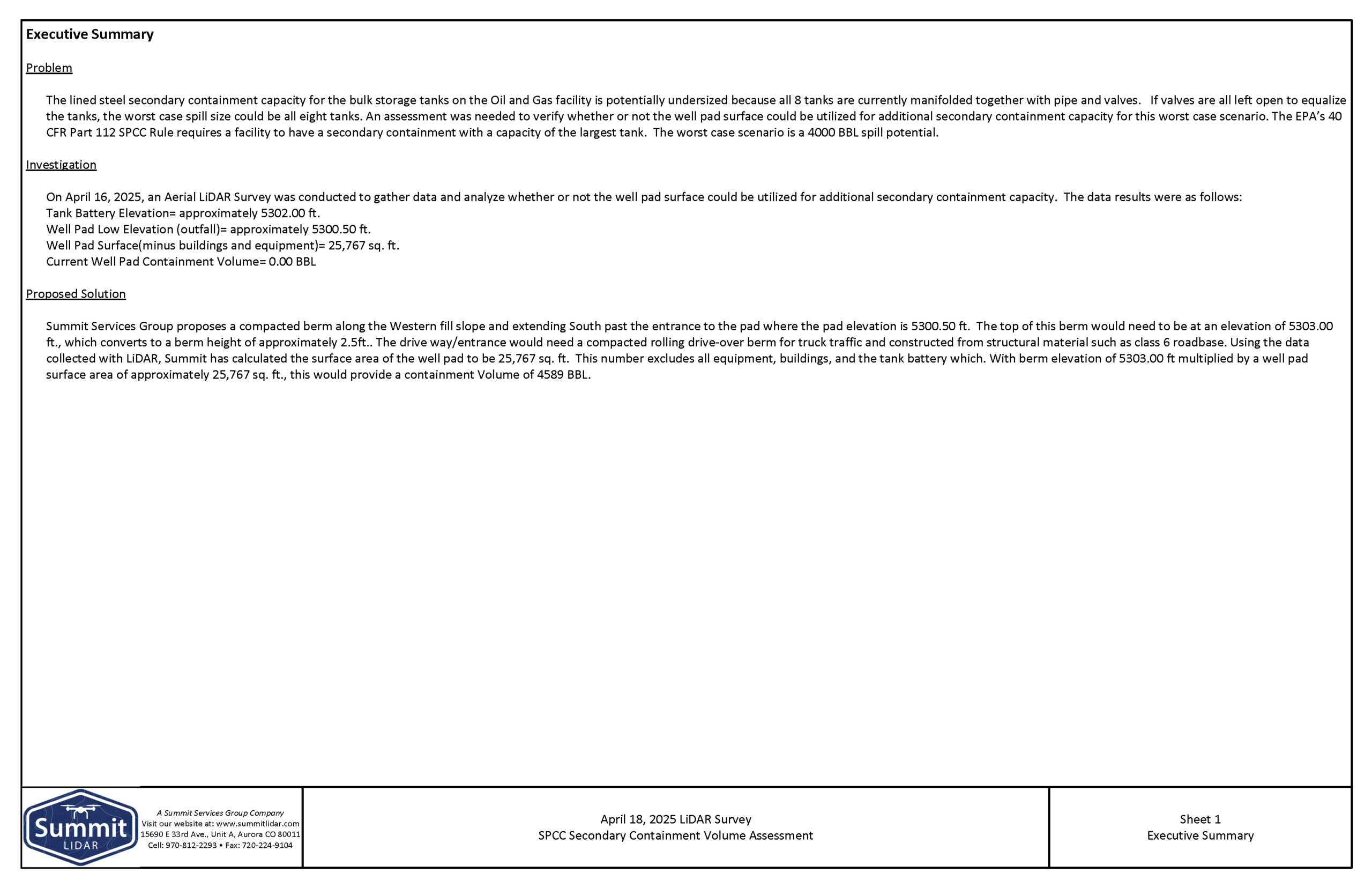
The first page of the report consists of an Executive Summary. The problem is identified, the investigation is summarized, and a solution is proposed. In this particular case, Summit LiDAR conducted a drone mapping service for the bulk storage tanks on an Oil and Gas facility. The problem identified was that the facility’s existing secondary containment may not be large enough to handle a worst-case spill. The existing tanks (8) are connected, so a spill could involve their combined volume (up to 4,000 barrels). To stay compliant with 40 CFR Part 112, the site must have enough containment capacity for this scenario. The assessment evaluates whether the existing well pad surface can provide additional containment and help meet those requirements without major reconstruction.
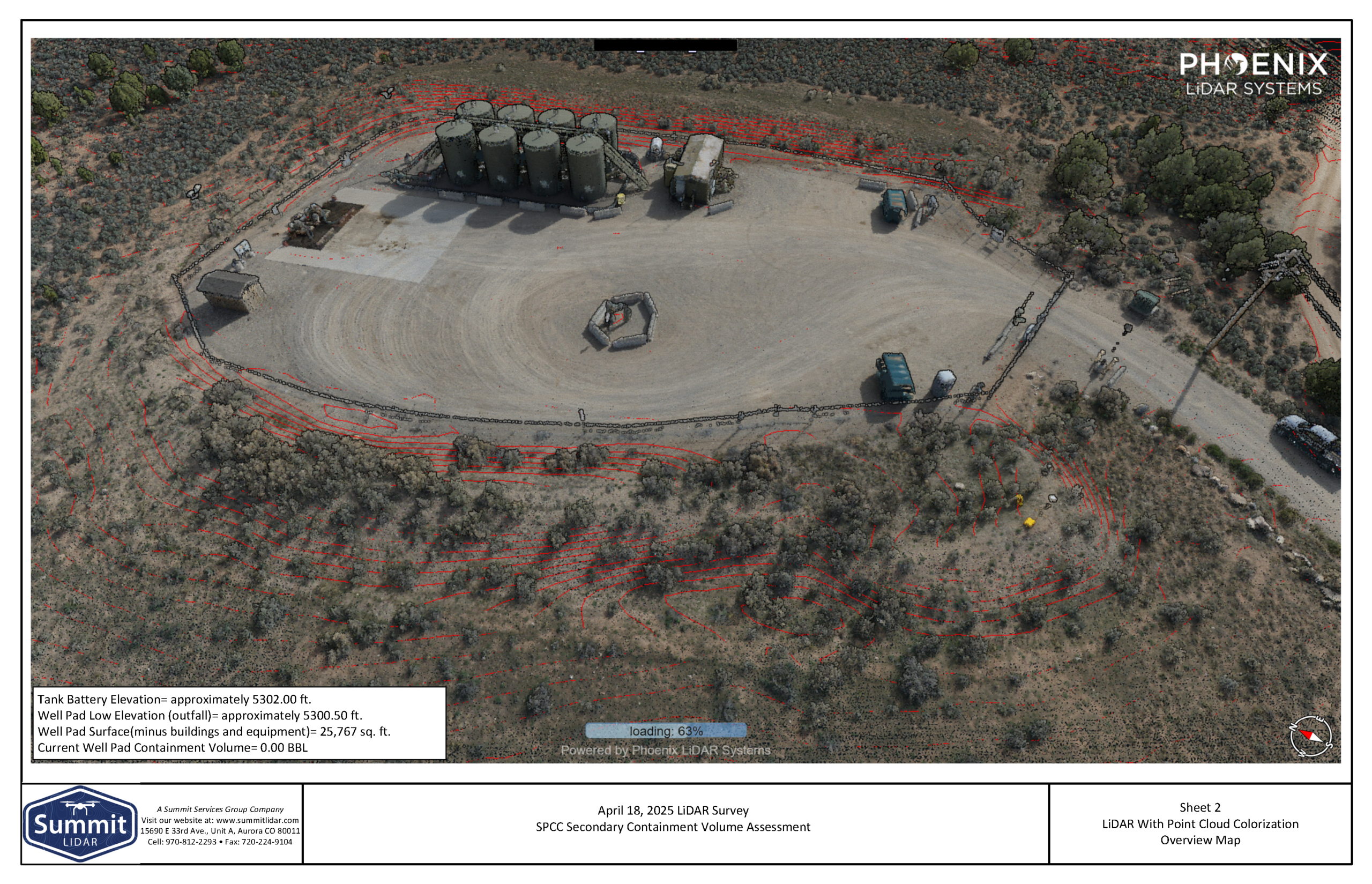
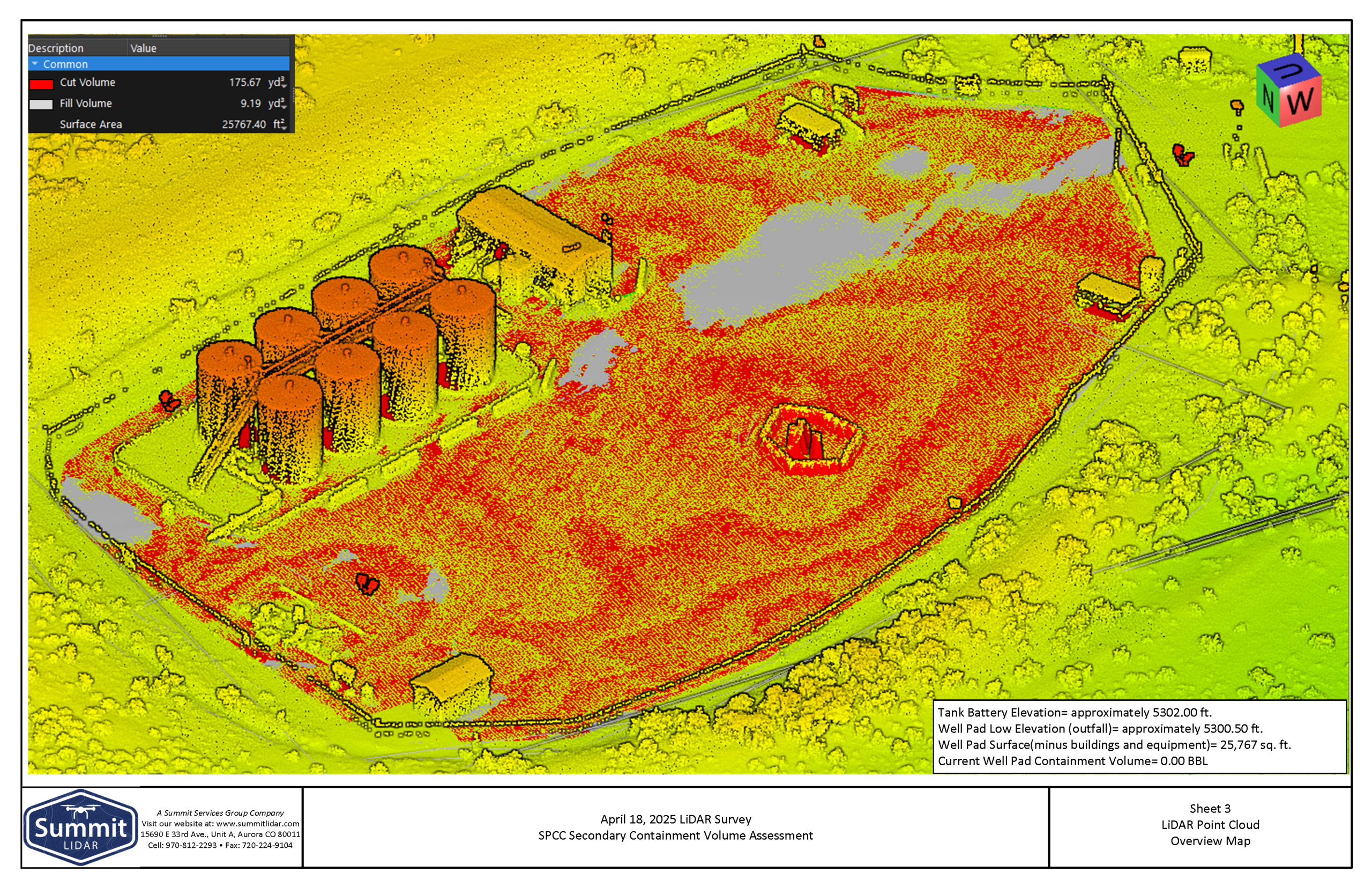
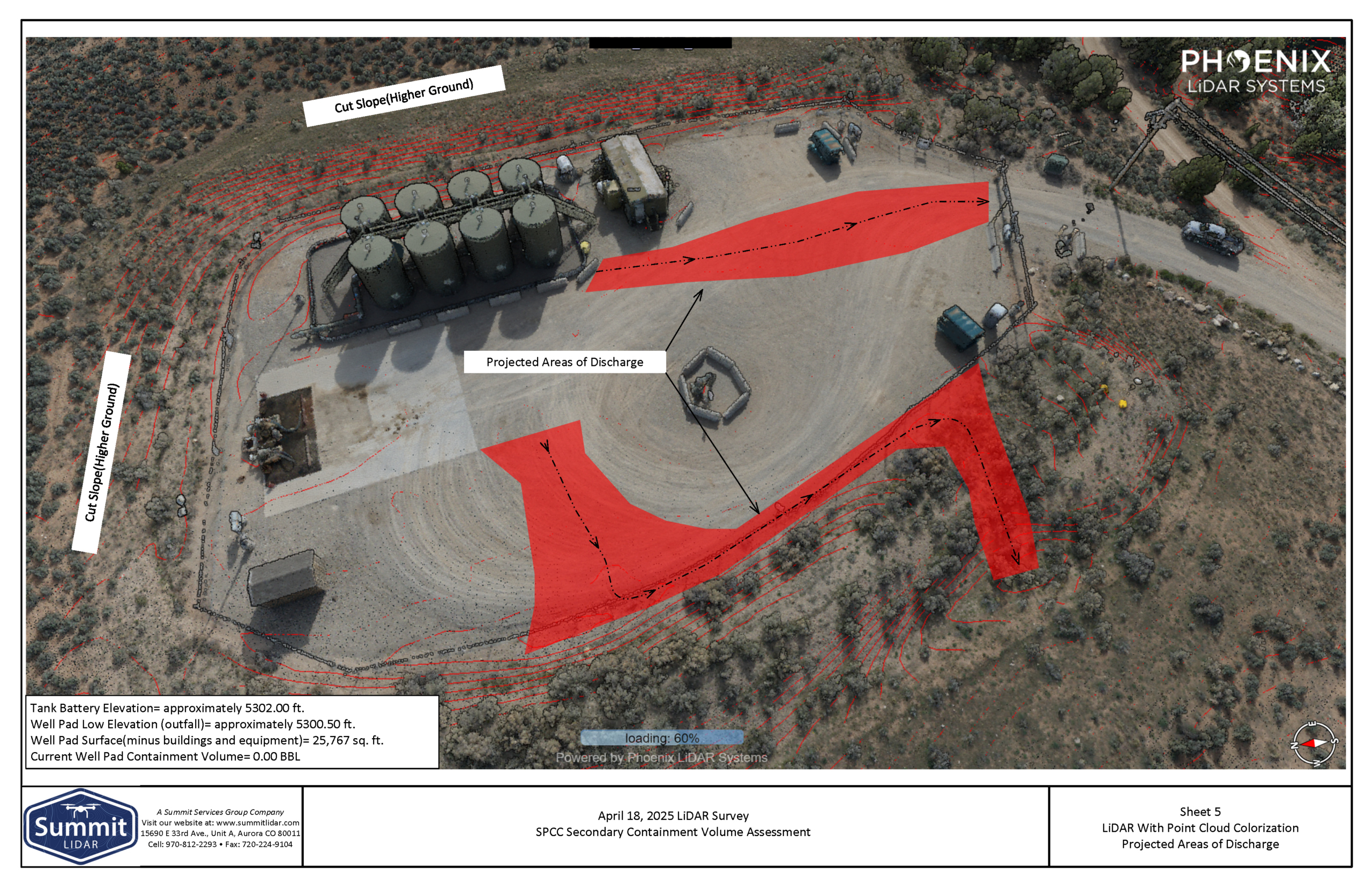
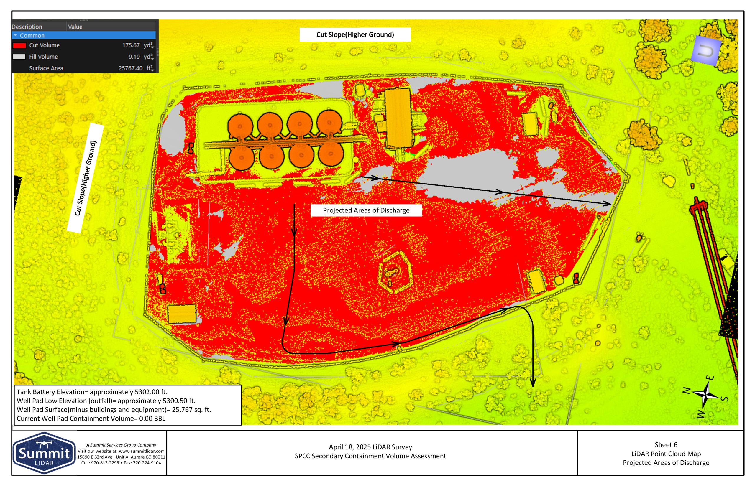
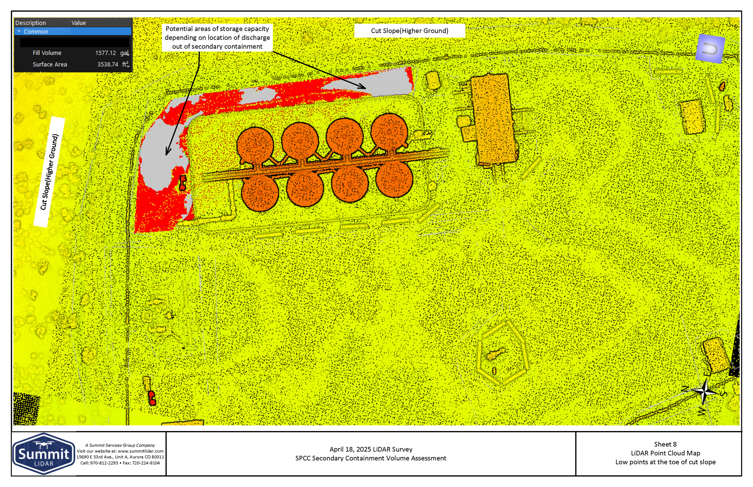
Point Cloud Maps
The report includes several Point Cloud maps all highlighting different aspects of the facility. These include the overview, project area of discharge, and low points at the toe of the cut slope. Together, these maps provide a detailed understanding of site elevations and drainage patterns, helping visualize how a spill could move across the pad and where containment measures would be most effective.
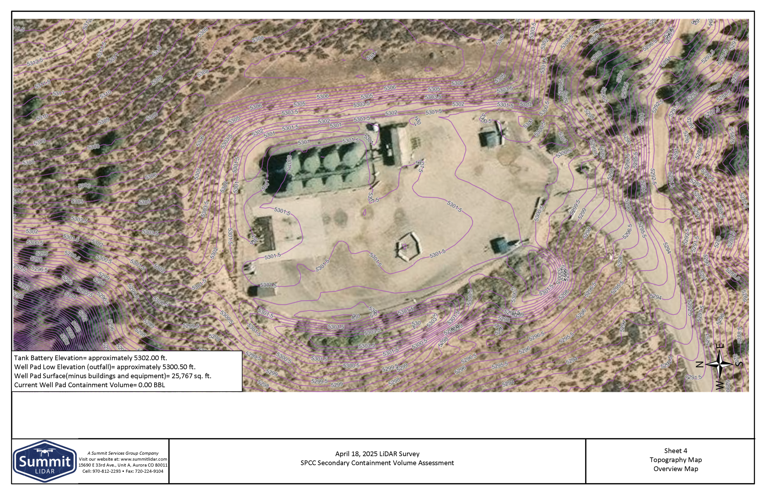
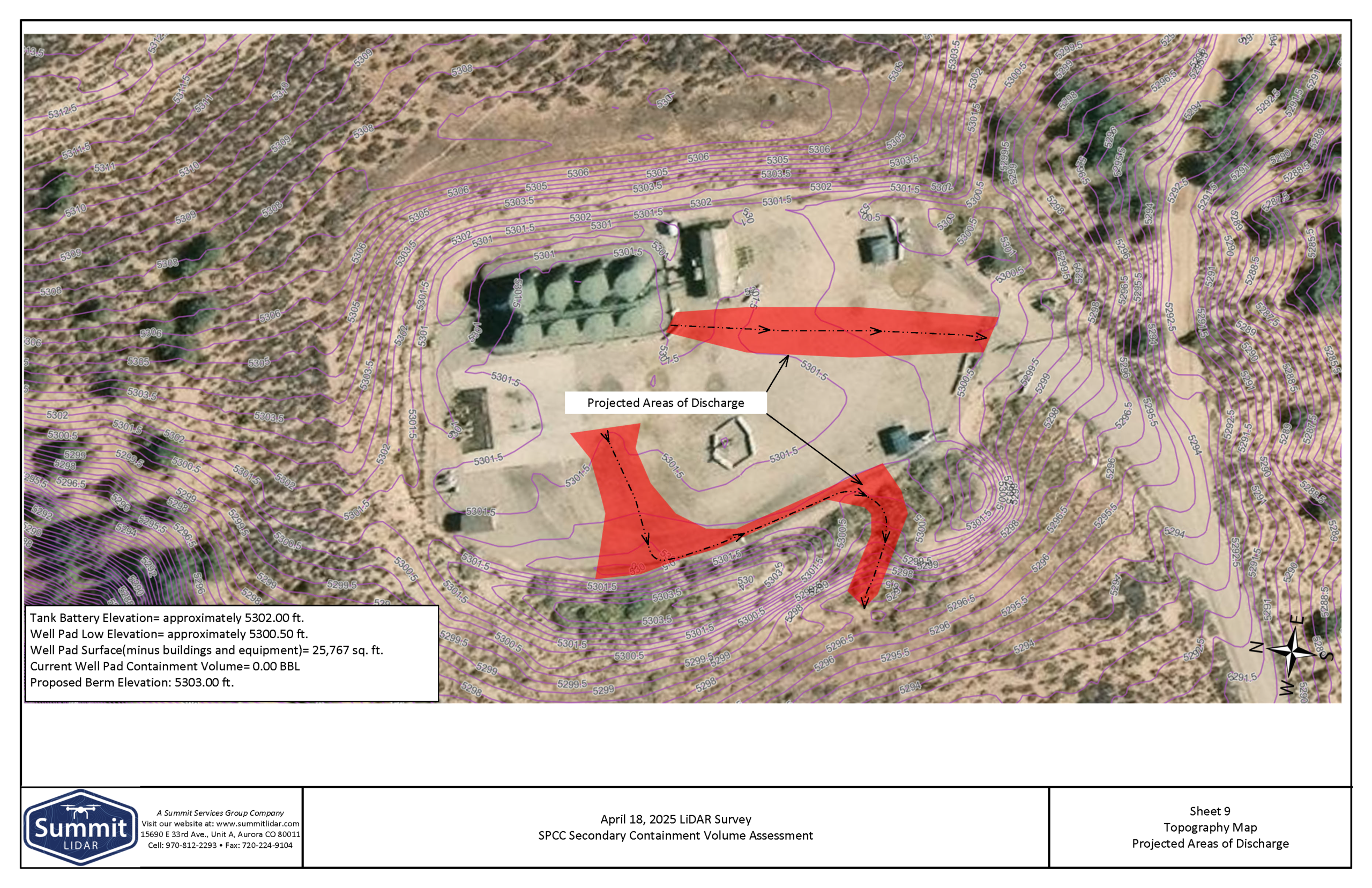
Topography Maps
In addition to point cloud maps, the LiDAR report includes topographic maps that clearly define site elevations. These maps highlight key elevations across the facility, including the tank battery elevation (approximately 5302.00 ft) and the lowest point of the well pad near the outfall (approximately 5300.50 ft).
Understanding these elevation differences is critical for SPCC planning, as they show how a spill would naturally flow across the site. In this case, the data confirmed that fluids would move toward the lower elevation at the edge of the pad. This insight helps determine whether the existing site conditions can be used to support additional containment capacity.
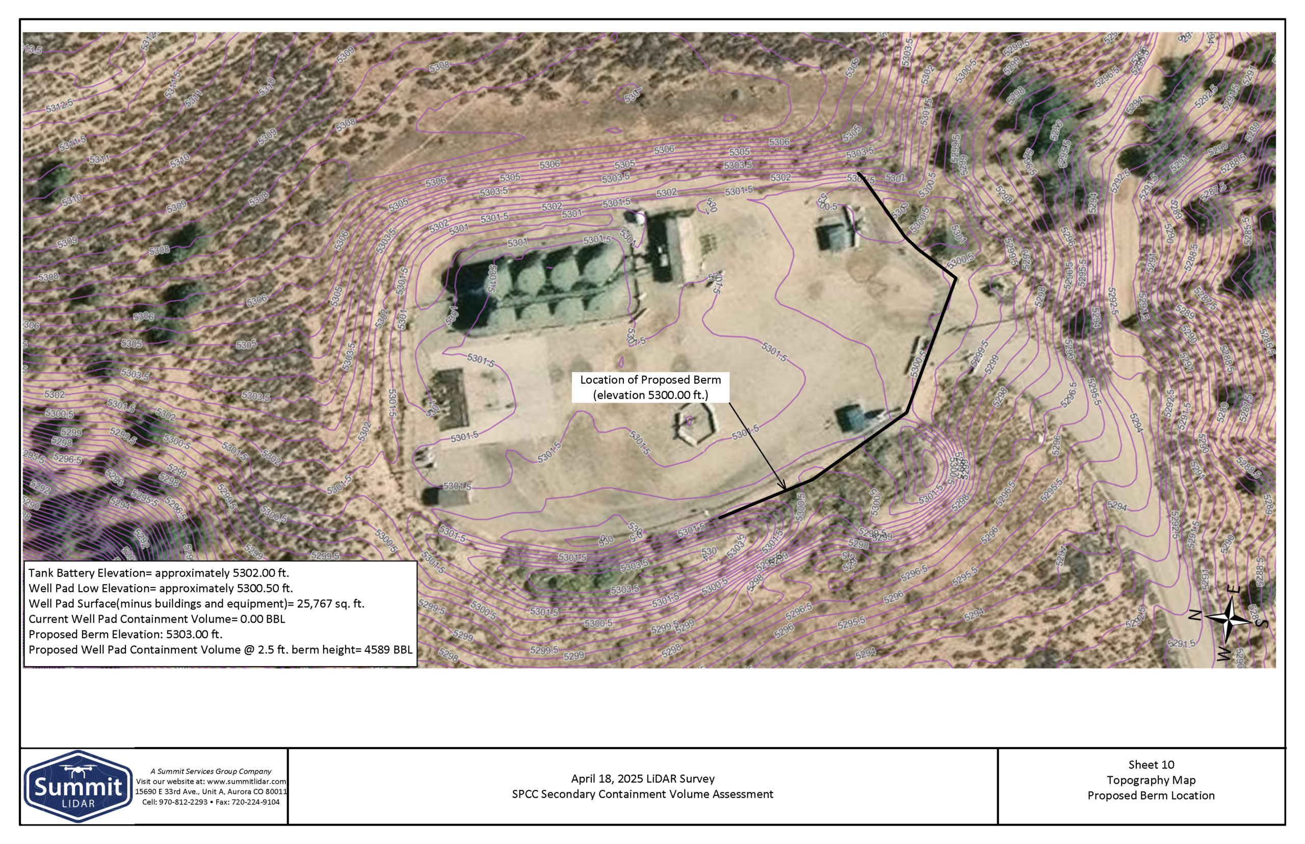
Proposed Berm Location
Because all eight tanks on site are connected, a worst-case spill could involve their combined volume. The existing steel containment alone may not be sufficient to meet 40 CFR Part 112 requirements, which prompted further evaluation using LiDAR data.
Based on the survey, Summit identified an opportunity to use the existing well pad surface—approximately 25,767 square feet (excluding equipment and structures)—as additional containment. By installing a compacted berm along the western fill slope and extending it south past the pad entrance, the site can effectively contain a potential release.
The proposed berm would have a top elevation of approximately 5303.00 ft, resulting in a height of about 2.5 feet at the lowest point. A reinforced, drive-over berm at the entrance would allow for continued truck access while maintaining containment integrity.
With this design, the well pad could achieve an estimated containment volume of 4,589 barrels—exceeding the 4,000-barrel worst-case scenario. This solution allows the operator to meet SPCC requirements by utilizing existing site conditions. In addition, it avoids the need for major reconstruction or tank relocation.
Efficient Solutions
LiDAR data turns SPCC planning into a measurable, data-driven process. In this example, detailed elevation modeling made it possible to identify flow paths, locate the true low point, and design a berm solution that uses the existing well pad to achieve compliant containment capacity. Instead of costly reconstruction, the site was able to meet 40 CFR Part 112 requirements with a practical, efficient approach. For operators, this means faster decisions, faster implementation, lower costs, and greater confidence that their site is prepared for real-world conditions.
This is what we mean with our tag lines: “Stop Guessing, Start Building” and “Precision Mapping, Delivering Confidence”. Our goal to provide actionable data should result in measurable savings in time and money. That’s real value, that’s what we do!
Our team at Summit LiDAR is happy to answer any questions regarding our services and discuss how using LiDAR can benefit your project—reach out today!