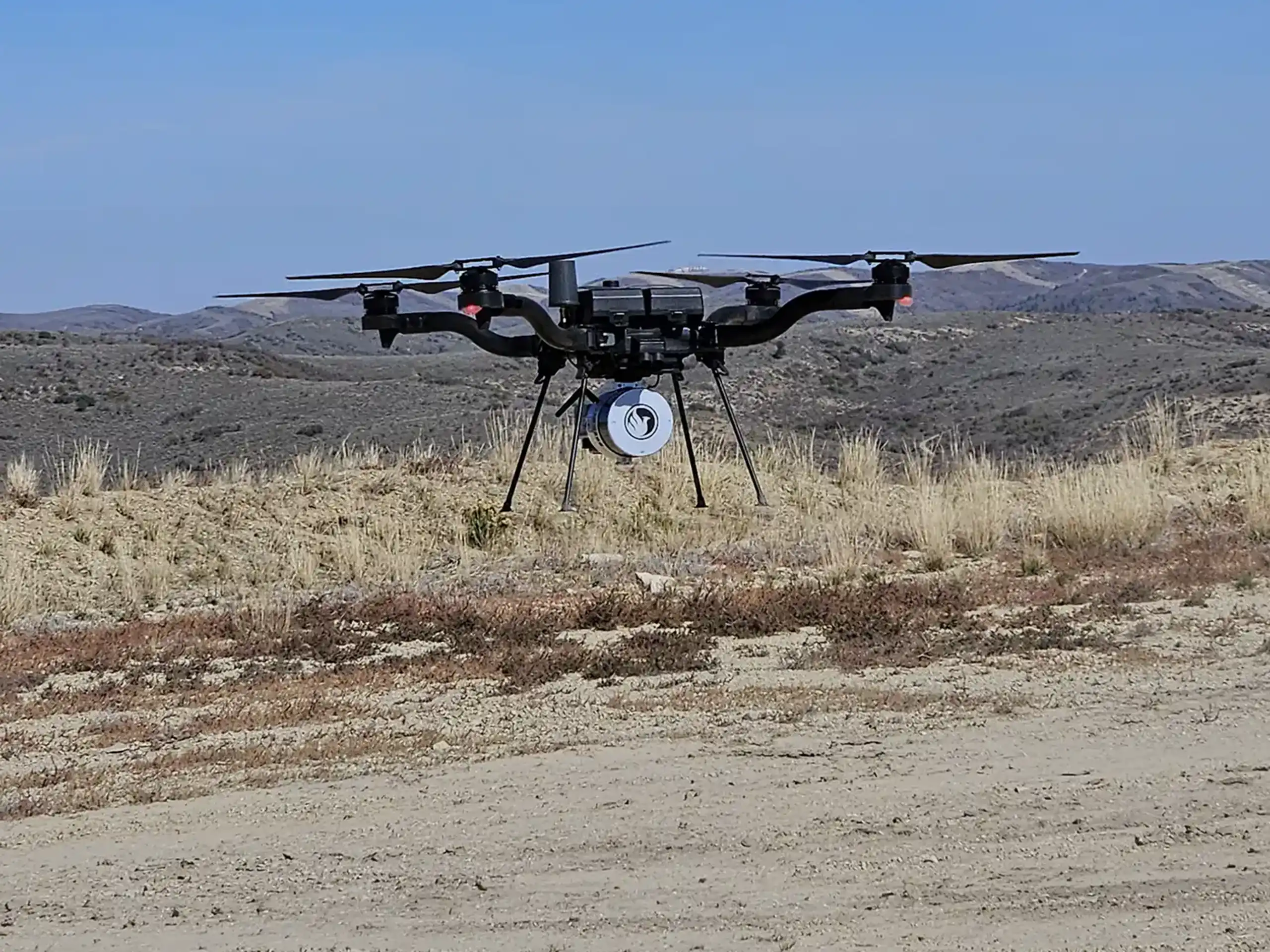
In addition to LiDAR mapping services, we also provide photogrammetry services across the state of Colorado with hubs in Denver and Grand Junction. Photogrammetry differs from LiDAR in that it captures and compiles aerial photos instead of reflected laser pulses. We use a specific drone, DJI Matrice 4E, and process the data through Propeller Aero. This platform converts the photos into detailed 3D site models and measurable surfaces that teams can use for tracking progress, volumes, and site conditions.
Why We Use the DJI Matrice 4E and AeroPoints
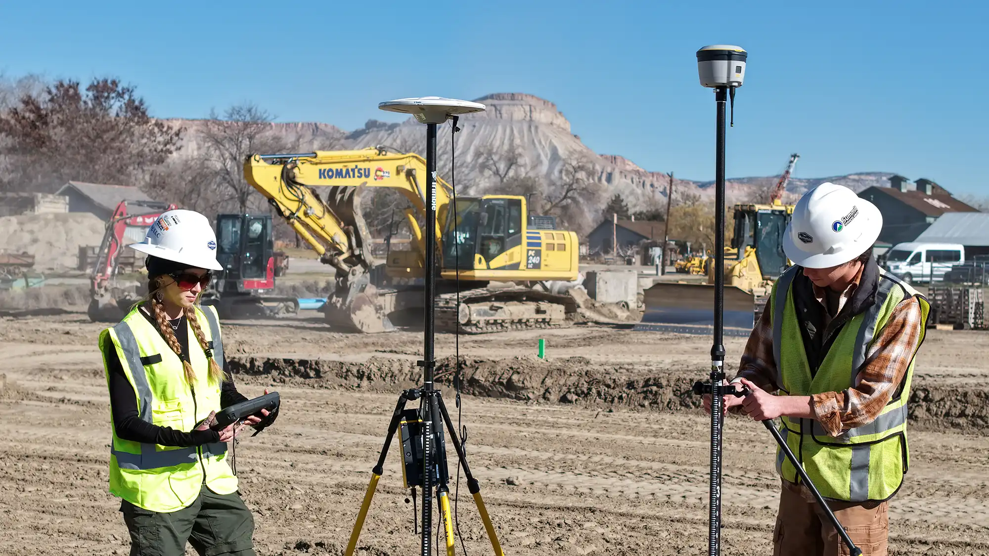
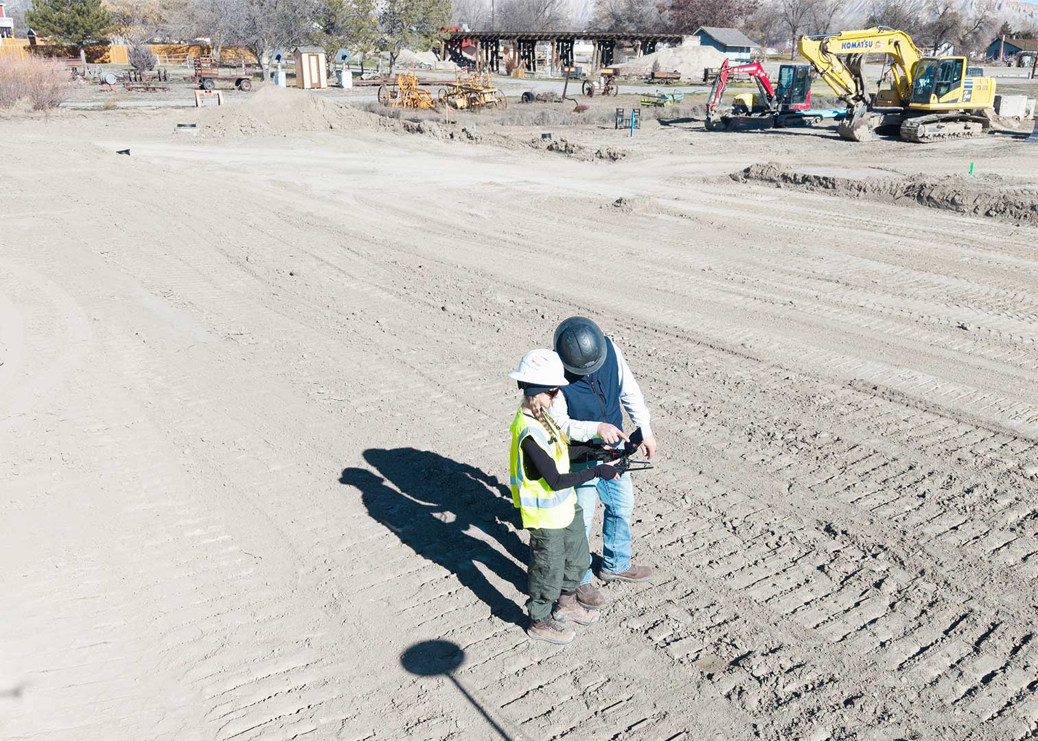
We use the DJI Matrice 4E because it’s built for this kind of work. It’s capable of high-resolution imaging, reliable GPS, and full compatibility with Propeller’s processing platform.
Additionally, we set out Propeller AeroPoints alongside the drone flight. These act as reference markers that record their exact position while the drone is in the air. When the flight is done, that ground-level data is used to fine-tune the drone’s positioning during processing. That’s what gets us to survey-grade accuracy across Colorado’s varied terrain.
How Propeller Aero Processes the Data
Once our team completes a drone flight, the raw imagery and GPS data are uploaded directly to Propeller’s cloud-based platform. From there, Propeller’s geospatial team takes over. Here is what happens behind the scenes:
- Georeferencing: The 3D model is tied to ground control points (GCPs) on the site, anchoring it to real-world coordinates. Propeller supports over 5,000 published coordinate reference systems, so the data can be delivered in whatever system your project requires.
- Image alignment and stitching: All captured images are aligned and stitched together to build the 3D model.
- Point cloud generation and validation: Propeller produces a 3D point cloud and validates its accuracy.
- Orthophoto and surface creation: The point cloud is used to generate elevation models and a geometrically corrected orthophoto — a true-to-scale aerial image of the site.
- Final accuracy check: Both the site model and surface undergo a final quality review before delivery.
Once the dataset is ready, clients receive a detailed processing report that includes image quality summaries, ground control accuracy metrics, and survey metadata so results can be independently verified.
When using a recommended drone like the DJI Matrice 4E alongside AeroPoints and following best practices, Propeller’s processing pipeline can achieve survey-grade accuracy to within 3 centimeters (1/10 of a foot).
PPK: Faster Processing, Better Accuracy
One of the key technologies used in Propeller’s workflow is Post-Processing Kinematic positioning, or PPK. Rather than relying on a real-time data connection during the flight, PPK records precise positional information from both the drone and a ground-based reference point, then reconciles that data after the flight is complete. The result is more accurate georeferencing, faster turnaround times, and a more reliable dataset overall. This is especially true on large or complex sites where real-time signal loss can be a problem. For Colorado construction teams that need frequent, dependable surveys, PPK is a significant advantage over standard GPS-based workflows.
What Construction Teams Can Do With the Data
Photogrammetry is particularly well-suited for active construction sites. The deliverables include files types such as orthophotos (GeoTIFF, JPG, PNG, KML), 3D surfaces (DXF, TTM), point clouds (LAZ, LAS, CSV), and contours (DXF, Shapefile). These integrate directly into the tools and workflows your team is already using. The data isn’t just something to look at, it’s something you can actually act on:
- Topographic mapping: Generate accurate topo maps of existing conditions before grading begins. Or, capture updated topo after each major earthwork phase for comparison against design.
- 3D point cloud: The point cloud can be imported into CAD and modeling software your team uses in the field and office. This allows engineers and operators to review site geometry, check grades, and verify quantities without leaving their desk.
- Phase overlays: One of the most powerful features in Propeller is the ability to overlay surveys from different points in time. By comparing where a site was at the start of a phase to where it is now, project managers can see exactly how much dirt has moved, confirm progress against the schedule, and identify areas that are ahead of or behind plan.
- Volume calculations: Accurately calculate cut and fill volumes, verify earthwork quantities, and track stockpile changes over time. This can all be done directly from the 3D surface model without manual field measurements.
- Equipment and machine integration: Processed surface files can be exported and loaded directly into machine control systems. This gives operators in the field the most current site data to guide grading and earthmoving operations.
- Progress tracking and collaboration: The entire project team — engineers, owners, contractors, and subcontractors — can access the platform from any device. Whether you’re in the field or in the office, you can keep everyone aligned without the need for specialized GIS software.
- Topsoil Tracking and State Verification: Photogrammetry is also a valuable tool for oil and gas operators in Colorado. It gives operators a precise, documented record of topsoil pile volumes. This helps captures the difference in elevation between the stripped surface and the top of the stockpile to quantify exactly how much material has been salvaged.
Ready to Add Photogrammetry to Your Colorado Project?
Summit LiDAR provides photogrammetry services throughout Colorado for construction, civil, land development, oil and gas, and environmental projects. Whether you need a one-time site capture or recurring progress surveys, our team handles everything from flight planning to final deliverable. All powered by Propeller Aero’s industry-leading processing platform.
Contact us today to learn how photogrammetry services can give your Colorado project team better data, better decisions, and better outcomes.